Academic research
 hbits - Home
Pedestrian zone and daily life in Brussels
Mapping the temporal, spatial and social context of the use of a pedestrian zone
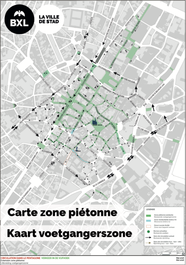
Background: pedestrian zone in Brussel
To answer to a pressing question of the community of Brussels, a decision was taken to extend the pedestrian zone in down-town Brussels. The expansion is located around the Anspachlaan and the Grote Markt (the green zone in the figure). Despite administrative implementation, the pedestrian zone is not functional yet. A number of road works are still ongoing to connect all separate zones. One major road work site is located at Fontainais. The pedestrian zone is expected to be fully functional by the end of 2018. The completing also kicks off this project.
The project: the use of the pedestrian zone
The aim of this project is to analyse the impact of the pedestrian zone on daily life in down-town Brussels. Amongst other things, we are interested to see how a car-free zone affects the daily activities of the residents and if certain lifestyle changes are permanent.
The questions central to this project are: how and in what way will the pedestrian zone be used? How will the pedestrian zone affect people’s daily life? And how do users experience the pedestrian zone?
The challenges: measuring time and space
Partners in this project are the BSI (Brussels Studies Institute), the ULB (Université libre de Bruxelles), the Research Group TOR and hbits. hbits is responsible for mapping daily life and the use of the pedestrian zone. To do so, it uses MOTUS. In this project, it is important to take both time, space, and social interaction into account. Space is defined as the pedestrian zone itself (probably divided in subzones) as well as the interaction with the space outside the pedestrian zone. Furthermore, the use of the pedestrian zone is not only characterised by a temporal context, that is, when and how often is it used, but also by a social context (i.e. with whom and for what reason).
In this project, the MOTUS-app will use API-locations. The API allows us not only to follow the trajectory of respondents along spatial dimensions, it also allows us to ask specific questions about their experience of the pedestrian zone. Combining the MOTUS-app with API-location allows hbits to map the temporal (i.e. when, how often, for how long), the spatial (i.e. where) and social (i.e. what and with whom) context of the use of the pedestrian zone.
“To map the temporal, spatial and social context of the use of the pedestrian zone, the MOTUS-app uses API-location.”
In short
By the end of 2018, Brussels completes road works on the expansion of the pedestrian zone.
That is also the start of this project, which aims to analyse the impact of the pedestrian zone on daily life in down-town Brussels.
Combining the MOTUS-app with API-location allows hbits to map the temporal (i.e. when, how often, for how long), the spatial (i.e. where) and social (i.e. what and with whom) context of the use of the pedestrian zone.
Cases
DOWNLOAD
Leave your name and email address to get access to the downloads.
We we’ll add you to our contact list.
You can unsubscribe at any time if you no longer want to receive messages from us.
Thank you.
Don’t hesitate to contact us if you have any more questions.